addCustomBasemap
Add custom basemap
Description
addCustomBasemap(
adds the custom basemap specified by basemapName,URL)URL to the list of basemaps
available for use with mapping functions. basemapName is the name you
choose to call the custom basemap. Added basemaps remain available for use in future
MATLAB® sessions.
addCustomBasemap(___,
specifies name-value arguments that set additional parameters of the basemap.Name=Value)
Examples
Add a custom basemap to view locations on an OpenTopoMap® basemap, then remove the custom basemap.
Specify values for these arguments:
A name that identifies the custom basemap.
The URL of the map tiles. For load balancing, this provider has three servers that you can use (
a,b, orc).An attribution that gives credit to the provider of the map tiles. When you plot data, this attribution appears at the bottom of the map. Map tile providers can define specific requirements for the attribution.
A display name for the custom basemap. This name appears in the Imagery tab of Site Viewer.
name = "opentopomap";
url = "a.tile.opentopomap.org/${z}/${x}/${y}.png";
attribution = "©OpenStreetMap contributors";
displayName = "Open Topo Map";
Use addCustomBasemap to load the custom basemap, and then create a Site Viewer that uses the custom basemap.
addCustomBasemap(name,url,Attribution=attribution,DisplayName=displayName)
viewer = siteviewer(Basemap=name);

After you add a custom basemap, the custom map is available in new Site Viewer windows. Note the Open Topo Map basemap icon in the Imagery tab.
viewer2 = siteviewer;

Use removeCustomBasemap to remove the custom basemap. Then, open a new Site Viewer. Note the Open Topo Map basemap option is no longer available in the Imagery tab.
removeCustomBasemap(name)
viewer3 = siteviewer;

Input Arguments
Name-Value Arguments
Tips
You can find tiled web maps from various vendors, such as OpenStreetMap®, the USGS National Map, Mapbox, DigitalGlobe, Esri® ArcGIS Online, the Geospatial Information Authority of Japan (GSI), and HERE Technologies. Abide by the map vendors terms-of-service agreement and include accurate attribution with the maps you use.
Mapping Toolbox™ enables additional strategies for adding custom basemaps. For example, you can add custom basemaps from vector basemaps hosted by Esri, from MBTiles files, or from georeferenced images. Several of these strategies do not require internet access. For more information, see
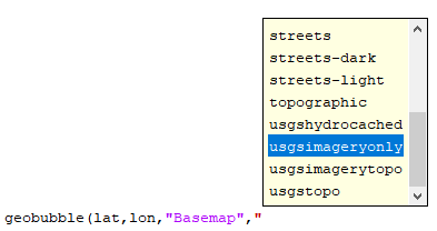
addCustomBasemap(Mapping Toolbox) and Use Basemaps in Offline Environments (Mapping Toolbox).To access a list of available basemaps, press Tab before specifying the basemap in your plotting function. This image shows a sample list of available basemaps, including several custom basemaps from the USGS National Map.
Version History
Introduced in R2019b
See Also
geobasemap | geobubble | removeCustomBasemap | readBasemapImage (Mapping Toolbox) | addCustomBasemap (Mapping Toolbox)
Topics
- Use Basemaps in Offline Environments (Mapping Toolbox)